National Parks
Fun and Exciting Things to Do Mount Rainier National Park

Fun and Exciting Things to Do Mount Rainier National Park

We may earn money or products from the companies mentioned in this post.

Mount Rainier National Park is located in Washington State in Pierce County and Lewis County. It was established on March 2, 1899, and covers an area of ​​370 square miles around Mount Rainier, a 14400 ft high volcano and the highest peak in the Cascade Range. The mountain rises from the surrounding area, which has an average height of 1500 ft.
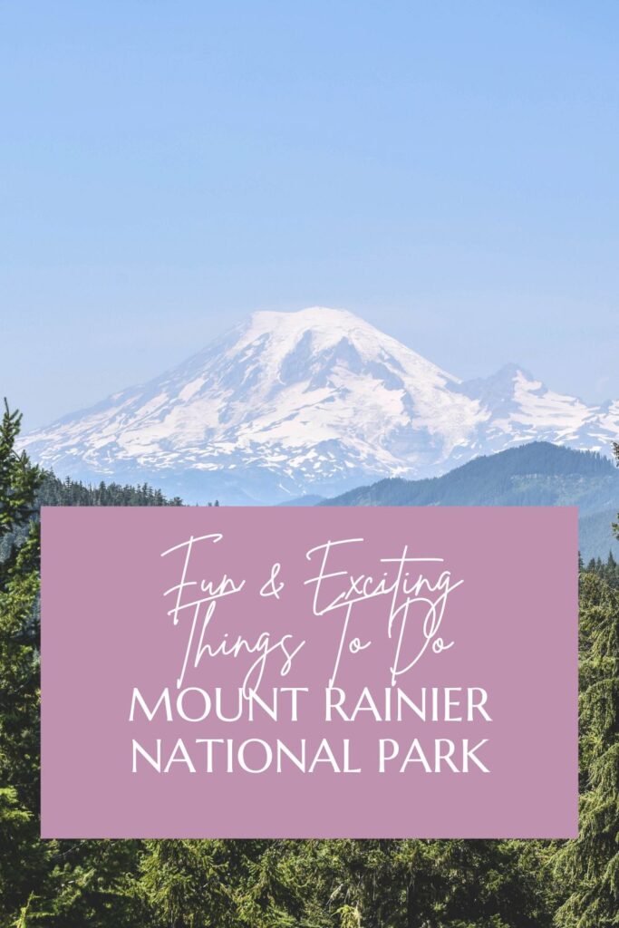
Mount Rainier National Park is located in Washington state in Pierce County and Lewis County. It was established on March 2, 1899, and covers an area of ​​370 square miles around Mount Rainier, a 14400 ft high volcano and the highest peak in the Cascade Range. The mountain rises from the surrounding area, which has an average height of 1500 ft.

Soon after the European settlement of the Northwest, Mount Rainier became a destination for tourists. In 1885 the Longmire family opened a small inn on the hot springs that now bear their name. The advance in agriculture, forestry, and mining led to efforts to preserve the mountain and its picturesque surroundings. 

On March 2, 1899, Congress passed legislation establishing Mount Rainier National Park. On November 16, 1988, large parts of the national park were protected as wilderness, which today includes 97% of the area of ​​the national park. 

In February 1997, the park was recognized as a National Historic Landmark and listed as a Historic District on the National Register of Historic Places because of its exemplary master plan for the further development of national parks. The Mount Rainier National Park Master Plan of the 1920s represented a major evolution in the management of protected scenic and recreational land. In addition, there were the surviving historic National Park buildings of the 1920s and 1930s such as the Longmire Administrative Building and the Ranger Station, and the Inn at Paradise.

Climate

Mount Rainier National Park is very wet. Because of the high humidity, Mount Rainier is often shrouded in clouds for weeks, and equally long periods of rain are not uncommon. The main visiting time is June to September. Statistically, July and August are the driest and warmest months with the most days of fine weather, but sudden changes in the weather, rain, and fog are also possible during this time.

What To Do And See

The national park is visited annually by an average of 1.8 million visitors. There are five tourist areas within the park, four of which have a visitor center, as well as numerous ranger stations. Park roads run halfway around the mountain to the south and east, dead-end roads leading to major attractions and visitor centers.

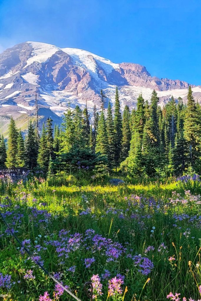
The Longmire Visitor Center is open year-round and houses a museum. In its vicinity, the 800-meter-long Trail of the Shadows, a nature trail, leads around a forest clearing. The visitor center in Paradise is at an altitude of 1600 meters and is surrounded by sub-alpine mountain meadows through which several hiking trails and trails lead.
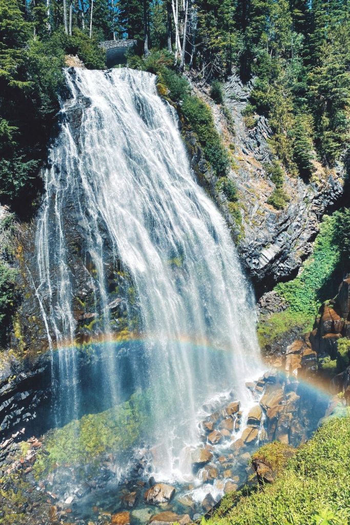
From the southern park road, a short trail leads to the 50-meter-high Narada Waterfall. Further down the park road is Reflection Lake, on whose water surface Mount Rainier is reflected when the weather is nice. The Box Canyon in the south of the park is a very narrow gorge up to 35 meters deep, which the Cowlitz River has carved into a lava flow. 

Located to the southeast of the park, the Ohanapecosh Visitor Center features the 2-mile Grove of the Patriarchs Trail. This nature trail leads to the oldest giant trees in the park, which are up to 1000 years old. The Sunrise Visitor Center is located to the east at an altitude of 6300 ft. A short nature trail and numerous hiking trails lead through the mountain meadows with views of Emmons Glacier and the summit crater. 

From the northwest, a trail leads to the Carbon River and into the wettest part of the park. The Carbon River Rain Forest Trail, a 500-meter-long nature trail through the dense rainforest, leads here. Other trails lead to Carbon Glacier or Mowich Lake. The 120 miles Wonderland Trail, which was laid out in 1916, leads around Mount Rainier and can be walked in 10 to 14 days.

Hiking Trails

A total of over 300 miles of hiking trails lead through the park. The summit of Mount Rainier is the goal of around 4,000 climbers every year. Climbing the summit usually takes two days. Ski lifts operate at Paradise from December to May. In addition to skiing, there is the possibility of snowshoeing or ski hikes. The Paradise Inn and the National Park Inn in Longmire offer accommodation in the park, as well as five campgrounds.

Mount Rainier National Park exists because of "The Mountain." If you are in Seattle, Washington, and ask if The Mountain is out, everyone knows you are asking if the sky is clear enough to see the majestic 14,410-foot-high Mount Rainier. That's nearly three miles high. Think about it. Mount Rainier is not the only reason to go to the park though. The surrounding ecosystem is diverse and complex going from a rain forest to sub-alpine to alpine in almost three miles, so you can see old-growth forests, meadows, and glaciers in the same visit to the park.

As always, the best way to see any national park is to get out of the car and take a hike. There are miles and miles of hikes to enjoy, from a 93-mile hike around the mountain to some short and easy hikes that are great for a stroll in the park.

Across from the National Park Inn at Longmire, take a short 30-minute walk on the Trail of the Shadows to a cabin, probably built by early homesteaders. Watch closely. You may catch a peak of a bear sharing the area with you.

Two miles west of Longmire, start your climbing training with a .4-mile loop called Rampart Ridge. The brochure says this is a 20-minute walk. The brochure does not tell the complete truth. This is a steep trail through the forest to the top of a ridge, but the view is spectacular, so make the effort and do the climbing.

By all means, find time to take the Silver Falls Trail and see the Ohanapecosh River drop 75 feet. Do not leave the trail as the rocks surrounding it are dangerous and slippery.

Walk through the Grove of the Patriarchs and see the thousand-year-old Douglas fir and western red cedar trees. Stop often to appreciate the age of this forest and think of what it has seen during its life. Find the trailhead just west of the Stevens Canyon Entrance and walk the 1.3-mile loop. Take longer than an hour to do the hike. Relax and find the peace of the forest.

Hike the three-mile Shadow Lakes Trail starting at the Sunrise parking lot. See the White River Valley, look up to see the peak of the mountain, and just enjoy the wildflowers that cover the landscape.

There are crisscrossing hikes that start at the Sunrise parking lot. You can start on one, and return on another or just walk along from one to the next taking your time and marveling over the scenery all around you. From Shadow Lakes, pick up Sourdough Ridge, and climb to the top of the ridge to see not only Rainier but also Baker Glacier Peak and Mount Adams.

Start the seven-mile Glacier Basin Trail at the White River Campground and watch for mountain goats as you hike. You will also probably see lines of climbers aspiring to reach the top of Rainier. As you climb, you can pick up a half-mile offshoot trail to Emmons Glacier. See it as it is receding quickly during these years of global warming.

No matter where you hike in Rainier, stay on the trails. The ecosystems are fragile and often take hundreds of years to form. One footstep can destroy those hundreds of years of formation. Remember the air is thin and the rocks are slippery. But do one thing while you are there. Plan your return and next time let's climb to the top.

Soon after the European settlement of the Northwest, Mount Rainier became a destination for tourists. In 1885 the Longmire family opened a small inn on the hot springs that now bear their name. The advance in agriculture, forestry, and mining led to efforts to preserve the mountain and its picturesque surroundings.

On March 2, 1899, Congress passed legislation establishing Mount Rainier National Park. On November 16, 1988, large parts of the national park were protected as wilderness, which today includes 97% of the area of ​​the national park.

In February 1997, the park was recognized as a National Historic Landmark and listed as a Historic District on the National Register of Historic Places because of its exemplary master plan for the further development of national parks. The Mount Rainier National Park Master Plan of the 1920s represented a major evolution in the management of protected scenic and recreational land. In addition, there were the surviving historic National Park buildings of the 1920s and 1930s such as the Longmire Administrative Building and the Ranger Station, and the Inn at Paradise.

Climate

Mount Rainier National Park is very wet. Because of the high humidity, Mount Rainier is often shrouded in clouds for weeks, and equally long periods of rain are not uncommon. The main visiting time is June to September. Statistically, July and August are the driest and warmest months with the most days of fine weather, but sudden changes in the weather, rain, and fog are also possible during this time.

What To Do And See in Mount Rainier National Park

The national park is visited annually by an average of 1.8 million visitors. There are five tourist areas within the park, four of which have a visitor center, as well as numerous ranger stations. Park roads run halfway around the mountain to the south and east, dead-end roads leading to major attractions and visitor centers.

The Longmire Visitor Center is open year-round and houses a museum. In its vicinity, the 800-meter-long Trail of the Shadows, a nature trail, leads around a forest clearing. The visitor center in Paradise is at an altitude of 1600 meters and is surrounded by sub-alpine mountain meadows through which several hiking trails and trails lead.

Mount Rainier National Park Narada Falls
Photo Credit: Reddit

From the southern park road, a short trail leads to the 50-meter-high Narada Waterfall. Further down the park road is Reflection Lake, on whose water surface Mount Rainier is reflected when the weather is nice. The Box Canyon in the south of the park is a very narrow gorge up to 35 meters deep, which the Cowlitz River has carved into a lava flow.

Located to the southeast of the park, the Ohanapecosh Visitor Center features the 2-mile Grove of the Patriarchs Trail. This nature trail leads to the oldest giant trees in the park, which are up to 1000 years old. The Sunrise Visitor Center is located to the east at an altitude of 6300 ft. A short nature trail and numerous hiking trails lead through the mountain meadows with views of Emmons Glacier and the summit crater.

From the northwest, a trail leads to the Carbon River and into the wettest part of the park. The Carbon River Rain Forest Trail, a 500-meter-long nature trail through the dense rainforest, leads here. Other trails lead to Carbon Glacier or Mowich Lake. The 120 miles Wonderland Trail, which was laid out in 1916, leads around Mount Rainier and can be walked in 10 to 14 days.

Hiking Trails

A total of over 300 miles of hiking trails lead through the park. The summit of Mount Rainier is the goal of around 4,000 climbers every year. Climbing the summit usually takes two days. Ski lifts operate at Paradise from December to May. In addition to skiing, there is the possibility of snowshoeing or ski hikes. The Paradise Inn and the National Park Inn in Longmire offer accommodation in the park, as well as five campgrounds.

hiking

Mount Rainier National Park exists because of “The Mountain.” If you are in Seattle, Washington, and ask if The Mountain is out, everyone knows you are asking if the sky is clear enough to see the majestic 14,410-foot-high Mount Rainier. That’s nearly three miles high. Think about it. Mount Rainier is not the only reason to go to the park though. The surrounding ecosystem is diverse and complex going from a rain forest to sub-alpine to alpine in almost three miles, so you can see old-growth forests, meadows, and glaciers in the same visit to the park.

As always, the best way to see any national park is to get out of the car and take a hike. There are miles and miles of hikes to enjoy, from a 93-mile hike around the mountain to some short and easy hikes that are great for a stroll in the park.

Across from the National Park Inn at Longmire, take a short 30-minute walk on the Trail of the Shadows to a cabin, probably built by early homesteaders. Watch closely. You may catch a peak of a bear sharing the area with you.

Two miles west of Longmire, start your climbing training with a .4-mile loop called Rampart Ridge. The brochure says this is a 20-minute walk. The brochure does not tell the complete truth. This is a steep trail through the forest to the top of a ridge, but the view is spectacular, so make the effort and do the climbing.

By all means, find time to take the Silver Falls Trail and see the Ohanapecosh River drop 75 feet. Do not leave the trail as the rocks surrounding it are dangerous and slippery.

Walk through the Grove of the Patriarchs and see the thousand-year-old Douglas fir and western red cedar trees. Stop often to appreciate the age of this forest and think of what it has seen during its life. Find the trailhead just west of the Stevens Canyon Entrance and walk the 1.3-mile loop. Take longer than an hour to do the hike. Relax and find the peace of the forest.

Hike the three-mile Shadow Lakes Trail starting at the Sunrise parking lot. See the White River Valley, look up to see the peak of the mountain, and just enjoy the wildflowers that cover the landscape.

–> Check out our Crazy Camping Girl Etsy store – new items are added weekly!

There are crisscrossing hikes that start at the Sunrise parking lot. You can start on one, and return on another or just walk along from one to the next taking your time and marveling over the scenery all around you. From Shadow Lakes, pick up Sourdough Ridge, and climb to the top of the ridge to see not only Rainier but also Baker Glacier Peak and Mount Adams.

Start the seven-mile Glacier Basin Trail at the White River Campground and watch for mountain goats as you hike. You will also probably see lines of climbers aspiring to reach the top of Rainier. As you climb, you can pick up a half-mile offshoot trail to Emmons Glacier. See it as it is receding quickly during these years of global warming.

No matter where you hike in Rainier, stay on the trails. The ecosystems are fragile and often take hundreds of years to form. One footstep can destroy those hundreds of years of formation. Remember the air is thin and the rocks are slippery. But do one thing while you are there. Plan your return and next time let’s climb to the top.

.