Wild Adventures Await: National Parks in Wisconsin Beckon
We may earn money or products from the companies mentioned in this post.
There’s no equivalent of the Yosemite or Yellowstone national parks in Wisconsin. No National Parks in Wisconsin really, but National Forrests and Lakeshore sites abound. The state’s highest point is Timm’s Hill, and there’s a reason it’s not called Timm’s Mountain. Yet despite what they lack by way of mountains, geysers, and majestic waterfalls, Wisconsin’s national park service sites provide plenty of opportunities for hiking miles of trails, paddle boating on scenic rivers, picnic areas, swimming, and fishing. Although Wisconsin’s share of National Land covers a relatively small percentage of the state, numerous state parks and recreation areas exist to enjoy.

Apostle Islands National Lakeshore For Recreational Opportunities
The Apostle Islands, Wisconsin’s northernmost national park, is perfect for swimming and paddle boating. The 21 islands are thickly forested, but there are numerous clearings for campers, typically near the shore. Be careful with bears, though, which are especially prevalent on Stockton Island.
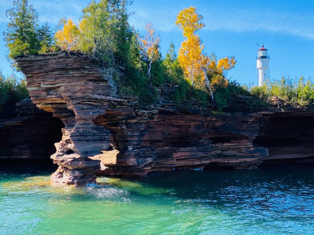
Swimming can be done on any of the islands’ many beaches. Those in canoes or kayaks may want to see the Sand Island or Mawikwe Bay sea coves, which feature rock formations. The Lakeshore Trail on the mainland offers 4.5 miles of scenic hiking. Scuba divers can check out the numerous sandstone caves carved into the shore but should note that even in summer months, the water temperatures at the lower depths are 10-20° F less than the surface water.
On the southern shore of Lake Superior in northern Wisconsin lie 22 islands and 12 miles of national scenic trails and lakeshore along the Bayfield Peninsula known as the Apostle Islands National Lakeshore. This 720-square-mile treasure is the historic home of French-Canadian voyagers and Ojibwa Indians. Early pioneers lived in the areas as fishermen and lighthouse keepers.
Stroll around Long Island and never leave the mainland on Apostle Island, which became a peninsula in the late 1970s.
Tour the Raspberry Island lighthouse from 1863 to 1947 and see the functional light beacon in operation.
Take the ferry from mainland Bayfield to Madeleine Island during the summer months. Go in the winter and drive your car over the 3-mile ice highway lined with Christmas trees across Lake Superior. Catch a ride on the wind sled during an ice breakup for a real trip to the island.
Explore the old brownstone quarry on Bass Island or the one-room schoolhouse on Sand Island.

Arrange a boat tour, Apostle Island style, with a boat shuttle around the islands. You can take a romantic sunset cruise, a boat trip to the six lighthouses, explore the sea caves, scuba dive for shipwrecks, or go bird watching.
Search the old-growth forests of Devil’s, Raspberry, Outer, and Sand Islands, watch for migratory birds, or practice your wildlife photography.
Plan a walking tour in La Pointe, the town on Madeleine Island, and visit the Madeleine Island Museum, filled with Ojibwa and French-Canadian voyager artifacts and history.
Rent a sea kayak and paddle around the waters of this beautiful national lake shore. Dock at Madeleine Island for lunch at a local restaurant and bicycle around the island for the remainder of the afternoon. Pitch a tent at the Big Bend State Park to end a perfect day at the Apostle Islands Lakeshore.
Hike and camp on Stockton Island with America’s densest black bear population. More than 35 bears inhabit this 10,000-acre wilderness island.
Keep a fishing pole and tackle box handy when visiting the Apostle Islands Lakeshore. Catch trout, salmon, or bass from any island docks or beaches. You can also fish from a boat in the waters of Lake Superior.

Tips & Warnings
Pay recreation user fees at the Park’s Headquarters in Bayfield on the mainland. The fees collected from camping, docking, programs, and parking at Meyers Beach go for the Apostle Islands Lakeshore maintenance, restoration, and improvements.
When traveling the Apostle Islands Lakeshore, prepare for possible severe storms during summer months. Dress in layers, bring rain gear and wear wet or dry suits if the weather and water conditions warrant.
Ice Age National Scenic Trail
Wisconsin’s version of the Appalachian Trail, the Ice Age Trail stretches 1,000 miles from the heavily wooded north to the cropland and plains in the south. The trail begins at Interstate State Park near St. Croix Falls in Polk County along the Minnesota border, veers south, then turns north again to end in Potawatomi State Park in Door County, located on a peninsula jutting out into Lake Michigan.
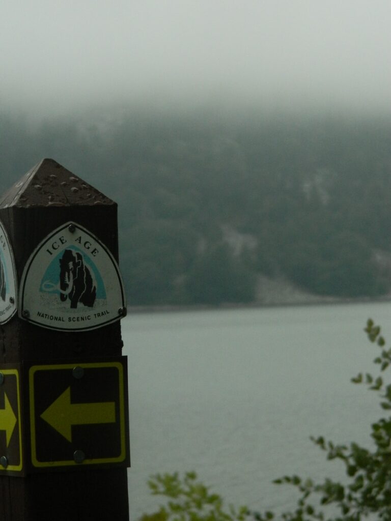
The terrain is never more difficult than rolling hills. The trail is primarily intended for hikers, as bicycling is only permitted in certain sections, and horseback riding is prohibited. Yellow markers indicate the trail path. Setting up primitive campsites is allowed throughout the trail. There are also several inns along the way.

The Ice Age National Scenic Trail is open all year round for the public to use. To find out the most current information about the Trail, they can be contacted by writing to the National Park Service at 700 Rayovac Drive, Suite 100 in Madison, WI 53711, or you can call them at 608-441-5610.
They can tell you what is happening in the area when you are traveling there. If there are any special events planned, they will know. You can also ask them about other interesting places to visit in the area, and they will know because they have a lot of information about the area. Make sure that you contact them in the early stages of planning your trip and that way you will be able to get the very most out of it that you can.
When you are visiting, be sure that you are aware that some of the areas of the trail do charge an entrance fee. You will want to check before you leave on your trip to know how much money you need to bring with you. When you are visiting this site make sure that you have comfortable shoes and clothing to explore all that you can when you are there. There can be a lot of walking involved, so make sure that you are up to it. There are so many different activities that you are bound to enjoy when you are there.
Make sure you have your camera and binoculars along so you can capture the awesome scenery in some photographs. Put them in a photo album so that you will always remember all that you did when you were there. There are other great souvenirs you can get so that you will always remember your trip fondly.

Visiting the Ice Age National Scenic Trail will be fun for everyone in your group, both the old and the young. Be sure you do a lot of research to get all you can from your visit. You can search on the internet and find a lot of information about the area, including places to stay overnight. Then make your plans early and get ready to have a great time. It will be a very special visit to the area for you.
North Country National Scenic Trail
The North Country National Scenic Trail goes from North Dakota to New York, and a 112-mile stretch goes through the northwestern tip of Wisconsin near the Apostle Islands National Lakeshore. For hikers only, the trail includes the state’s highest waterfall, the Big Manitou Falls, the pine barrens of the Douglas County Wildlife Area, the soggy Brule Bog, and several forests. The trail enters Wisconsin through Minnesota and exits via Michigan’s upper peninsula.
How to Hike the North Country Trail
The North Country Trail is an extensive hiking path from North Dakota to New York. This trail spans seven states in the Midwest, passing all of the Great Lakes and the Mississippi River. You need to account for this region’s vast distance and uncertain weather patterns before you hike the North Country Trail.
Start your hike along the North Country Trail in Crown Point in New York. This small city along the border with Vermont offers a rough path heading southwest through the forested heart of the Empire State.
Quicken your pace as you hike through the Allegheny State Park to take advantage of newly paved walkways. The state of Pennsylvania has paved nearly 100 miles of the path along the western border to facilitate outdoor activity.

Watch for horses and bicycles along portions of the Buckeye Trail in Ohio. This section of the North Country Trail dips through the southern half of Ohio and features sections with signs for mixed-use.
Rest your weary legs at the North Country Trail Association headquarters in Michigan. This office and inn provide educational tools on the ecology of central Michigan and a few beds available with advanced reservation.
Exhibit patience as you try to cross the North Country Trail via the Mackinac Bridge in the Upper Peninsula of Michigan. The bridge is closed to foot traffic which makes using a ferry a necessity if you want to reach the second half of the Trail.
Explore the original paths of the North Country Trail in northwestern Wisconsin. A hike through Chequamegon National Forest on the border between Wisconsin and Minnesota offers a blast into the past.
Buy a permit for Minnesota’s Boundary Waters Canoe Area Wilderness before you hike the North Country Trail. This vast expanse of lakes, rivers, and forests covers over a million acres, offering a respite for exhausted travelers.
Finish off your hike through the North Country by spending an evening at Lake Sakakawea. This crystal-clear lake in North Dakota is surrounded by a state park as well as several campgrounds with water views.
Tips & Warnings
Gather updated trail maps and state park information at stops along the North Country Trail. The reliability of updated maps depends on funding from individual parks though nationally certified portions feature updates on new construction. Dispose of old maps in recyclable bins at park offices to cut down on your ecological impact.
Visit the North Country Trail Association website for maps and other info.
St. Croix National Scenic Riverway
The St. Croix National Scenic River runs along the 252-mile St. Croix River, which forms the northern half of the border between Wisconsin and Minnesota. The riverfront includes many sandstone rock formations and forests, and the river is utilized for paddle boating. Eagles are often seen flying overhead. There are 100 primitive campsites along the river for overnight stays.

The Best State Parks For Recreational Activities
In addition to the four national parks, Wisconsin has 49 state parks filled with natural beauty located throughout the state. According to the state’s Department of Natural Resources, some of the most popular Wisconsin state parks include the Devil’s Lake State Park in south-central Wisconsin, which the Ice Age National Scenic Trail runs through, and Peninsula State Park, located on the Door County Peninsula near the trail’s western end.
